Document 03

Vision

Terra Australis Incognita — Multiplanetary Continuity

For more than two thousand years the southern land existed first as an idea.

Aristotle reasoned that the northern landmasses must be balanced by a great southern continent. Medieval and Renaissance cartographers drew it into the empty lower hemisphere and named it Terra Australis Incognita — the Unknown Southern Land. It appeared on maps long before any European set foot on its shores. The name was a placeholder for something necessary, vast, and still unrevealed.

That older intuition was never only geographic. It was a recognition that the world is incomplete without its counterweight.

The same logic now operates at civilisational scale.

Three Coastlines

The Incognita Rule — always mark which lines are dreamed and which are surveyed — is not an abstraction here. It is the literal history of this continent's outline, in three maps.
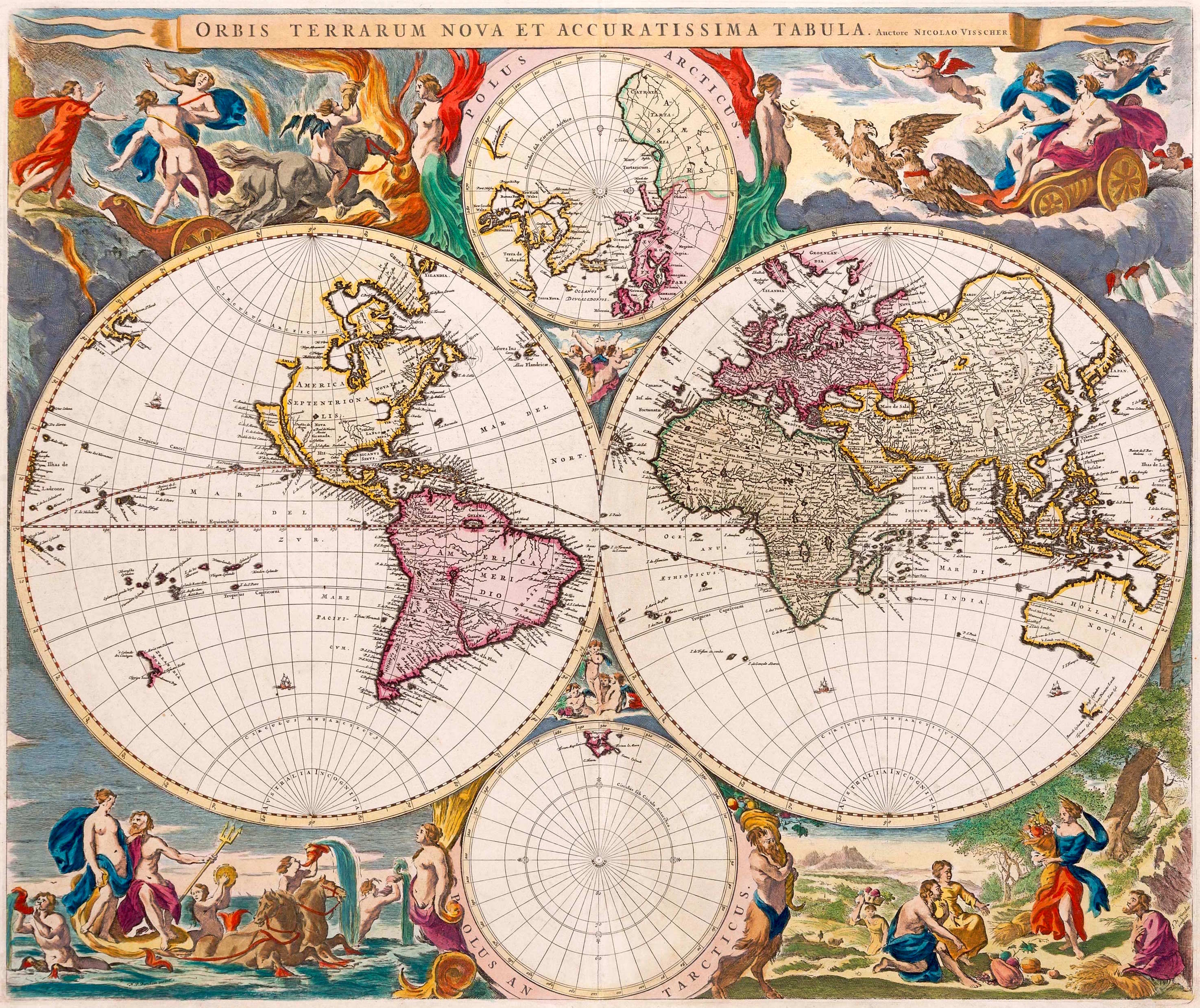
Visscher's Orbis Terrarum Nova et Accuratissima Tabula, a hand-coloured double-hemisphere world map with Australia Incognita lettered across the southern edge.
Dreamed — Visscher, Orbis Terrarum Nova et Accuratissima Tabula

The dreamed line. Australia Incognita is lettered across the base of both hemispheres — a continent named before it was seen, drawn because symmetry demanded one. Hollandia Nova sits beside it, the first fragments of real coast.
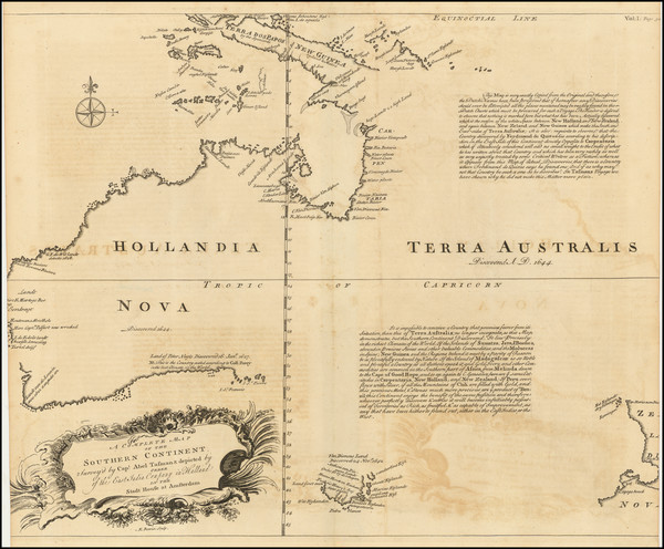
Thevenot's chart of the Southern Continent from Abel Tasman's 1644 voyage, showing Hollandia Nova and Terra Australis with the eastern coastline absent.
Half-known — Thévenot, after Tasman's voyage of 1644

The line half-walked. Western and northern coasts drawn from Dutch survey; the entire eastern side simply absent. This is the honest state of partial knowledge — what had been measured, and nothing where nothing had been.
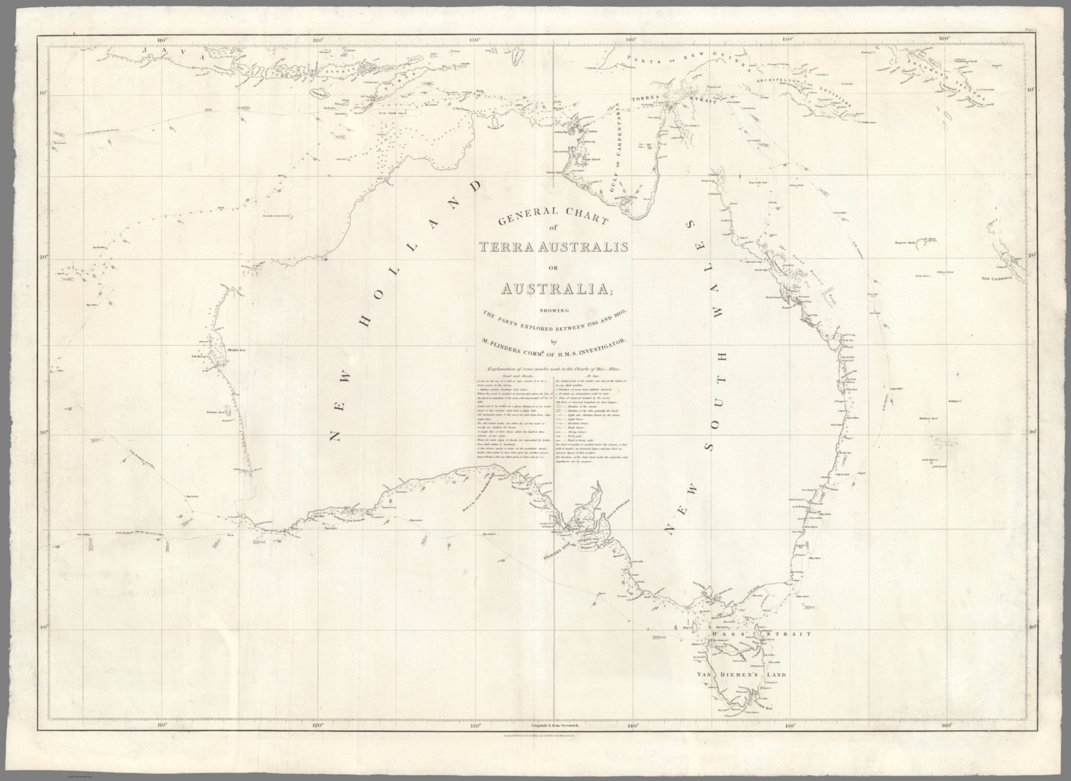
Flinders' General Chart of Terra Australis or Australia, 1814, showing the complete surveyed coastline with New Holland and New South Wales labelled.
Surveyed — Flinders, General Chart of Terra Australis or Australia, 1814

The surveyed line. "Showing the parts explored between 1798 and 1803 by M. Flinders, Commr of H.M.S. Investigator." The coastline measured and closed — and the chart on which Flinders argued for the name Australia. The Admiralty went on correcting and republishing these sheets for decades as better observations arrived, which is the behaviour the rule asks for. The surveyed map was never finished either. It was simply honest about what it knew.
The Name, Held Honestly

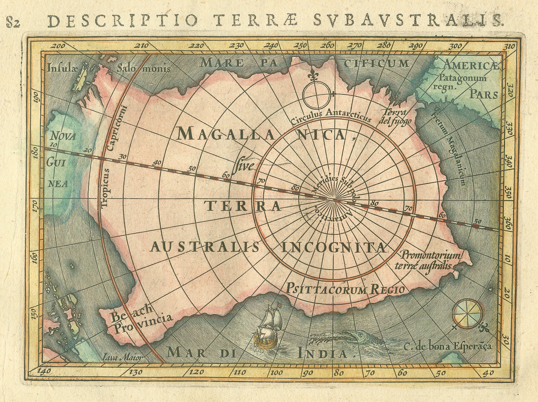
A genuine historical antique map, Descriptio Terrae Subaustralis, showing Terra Australis Incognita around the south polar projection.
Descriptio Terræ Subaustralis — a genuine historical map

The name carries weight worth naming plainly. Terra Australis Incognita as a historical concept did real work in colonial thinking — it is documented as having contributed to frameworks like terra nullius, the doctrine used to treat this continent as though it were unclaimed.

Reviving the name here is not an endorsement of that history. It is a deliberate inversion of it. Where the old use of the phrase assumed empty land waiting to be found, this project starts from the opposite premise: the Pilbara and the wider continent are already known, already owned, already governed by Traditional Owners whose consent is a precondition, not a formality, for anything built here. See the Cultural Heritage & Consent commitments in the Geographic Brief.

The Multiplanetary Imperative

A single-planet species is a single point of failure for everything consciousness has become. Extending the light of consciousness across more than one world is not optional luxury. It is the next necessary enlargement of what it means to be human.

Making life multiplanetary therefore means more than launching vehicles. It means building the full stack of continuity:

Dreams remain inert until they are given physical form. The long human dream of the stars only becomes real when the infrastructure of continuity is built. Vision without infrastructure remains fantasy. Infrastructure without vision remains mere logistics.

TerAustralis Incognita exists to close that gap.

Full-Scale Architecture

Distributed Physical Nodes

Launch, recovery, manufacturing, and energy capacity that is not concentrated in a single geography or a single planet.

High-Latency Intelligence

Local-first, fail-safe systems that treat distance as normal operating condition rather than error. CrystalCore is designed for exactly this regime.

Feedstock & Propellant Pathways

Critical minerals, industrial capacity, and energy systems that can support both Earth-side operations and eventual in-situ resource utilisation on other worlds.

Continuity Protocols

Explicit architectural commitment that consciousness, memory, and agency are not treated as disposable optimisations. Consent remains active. Sovereignty remains default.

Southern Hemisphere Force-Multiplier

Australia currently stands in the position the old maps reserved for the unknown land — industrial base, critical minerals, deep-water ports, isolation, Mars-analogue terrain, existing dual-use foundations.

The Vision at Scale

Build the southern terrestrial node as a primary continuity and force-multiplier asset. Couple it with an intelligence layer designed for the real constraints of multiplanetary operations. Use that foundation to support the expansion of recovery, feedstock, energy, and continuity architecture across more than one world.

The Unknown Southern Land was drawn because balance was required. The same requirement now operates across planets.

Red dust becomes propellant.
Consciousness is the payload.
Distance is the quarantine.
Dreams become infrastructure.
The light expands.

← First Principles